 So, to finish off the Three Capes, it was off to Cape Pillar for an overnighter. This walk is often done as a three-day walk, which allows a day to walk in, a full day to explore the cape and a day to walk out. I decided I could do it in two, and although it made for a longish day of walking on the first day, this is quite achievable. I'm not supremely fit, and the heaviest thing I've been used to carrying lately is my stomach, so minimising the weight by minimising the food to be carried was welcome. If I did it again, I'd probably go for three days, but in fact, the walk in to the campsite isn't long enough for a full-day's walk, and you will probably want to supplement it with a brief excursion further along the cape - the views are superb and will occupy you for hours if you wish.
 So the usual walk would be Day 1 - Walk to Perdition Ponds (or other campsite); Day 2- Explore the cape, which can take between 4 and 8 hours; Day 3 - Walk back out. Other campsites include Lunchtime Creek, Bald Hill. Some people apparently camp at the very end of the cape, Chasm Camp, where there is supposed to be a "soak" providing water. Good luck if you choose this. "The Oasis" was wet when I was there, and is a little further along than Perdition Ponds, but it wasn't "flowing", and was rather more a sequence of muddy puddles and damp patches. The water in Perdition Ponds was OK, despite the ranger's advice to me, and tasted perhaps a little better than Coles Bay water at a bad moment. Lunchtime Creek water is noticeably nicer however. The water at Perdition Ponds acquires some mineral salts taste from the surrounds. I think it could become quite "tasty" in dry weather.
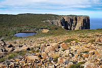
 The "new" track has been in place for some years now, and leaves from Fortescue Bay, maybe 100m back up the road from the ranger station. It is very well made and climbs gently around the hill and across a few small gullies, emerging on the flatter hilltop after a surprisingly easy climb. The track then undulates a little, climbing around Tornado Ridge and descending steeply to Lunchtime Creek. There's a phytophthera washing station here. Climbing begins again after Lunchtime Creek, but not greatly, and after crossing Hurricane Heath, the track comes out above Perdition Ponds, and cliff vistas start to be visible. The good campsite at Perdition Ponds is located very close to the 300m cliffs, although the scrub is quite thick, so sleepwalkers would have to navigate effectively to find their way into trouble...
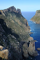
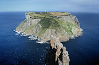
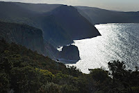
 At this point I dumped the pack and walked on with light gear and the camera. Beyond Perdition Ponds it is only a few minutes before you start to get superb, even stupendous, views. The track undulates along the cliff edges, providing new views every few minutes. The track is quite rough in places, and it does take longer to navigate than the quite small crow-flies distance would suggest. Not least, this is because you will be stopping every few minutes to gingerly approach the cliff edge and be gobsmacked at the view. The Blade is not to be missed, and provides a supremely spectacular view of the surrounding cliffs and Tasman Island. Beyond The Blade, there are further lookouts. I suspect I didn't find the last one - Chasm Lookout - as I didn't get the view of Cathedral Rock I discovered I should have had when I read the guidebook after my return(!) I'll have to go again to find that final lookout. Anyway, it's all very spectacular, and easily worth the effort of the walk.
View Cape Pillar in a larger map
No comments:
Post a Comment