Saturday 29 May 2010
New Blog
I've set up a new blog to take all the Huon Valley Nature items, and in general separate them from the bushwalking or "bush" items. Maybe I also need a fungi blog? Dunno, never mind. Here's the new blog.
Wednesday 26 May 2010
Mount Wellington Fungi

Found quite a few fungi last Saturday. Could have spent 12 hours messing about, but I think we need a few days of rain to really bring them out, without any severe frosts. I had a good walk around the lower slopes, including Myrtle Gully, where there are always a good range of fungi types. The mountain itself was seemingly covered in frost, maybe snow at higher levels. There were solidly frozen puddles at The Springs carpark anyway. See the Photos on Picasa.
I've been using the Nikon DSLR (D90) to take fungi photos. The depth of field is even more difficult than with the old Panasonic (DMC-FZ50). In addition, the Panasonic had a flip-out screen, and in fact the Panasonic's fixed lens was easier to manually focus than the cheap kit lenses I have on the Nikon. Nevertheless, some of the photos came out quite well. I have a mirror for focusing on the LCD screen from above. The D90, unlike earlier DSLRs has Live-View (LV). This means the mirror will flip up and allow the sensor to read the light in real time like a P&S camera. For this sort of photography, this is invaluable, despite some semi-amateur eejits on forums deriding the LV feature. The flip-out screen will also come to be seen as very useful, at least for some applications. Many of the photos were taken using the camera mounted upside-down on my big Manfrotto tripod. This was much easier than trying to balance the camera on bags and things at ground level, and then point it in the right direction. Having it upside down made for an interesting logic puzzle though, especially when using buttons and dials on the front of the camera - which way do I dial the wheel?
Sunday 23 May 2010
New cygnets at Franklin...?!
I'm not sure this is the right time of year for new cygnets, but this family seemed quite cheerful today. I have a suspicion that these adults are the same ones that raised the six cygnets I've been following for a few months. I'll see if I can match the markings on their beaks - these seem to have some individuality that might mark individual swans. Anyway, I was surprised to see new cygnets so close to winter - the last lot appeared just as summer started.


Recent Photos of Scooter and family
Scooter is still paddling about the Huon River near Franklin. I've seen him a few times recently, and got a few photos. He's often on his own when I see him, but sometimes with up to five others of his family. I've only seen six swans together recently, and I'm not sure which six they are, as most of them are adult-sized, or almost adult-sized. See the next post however, there are new cygnets about.


Quick Book Review - Created from Chaos
 A very interesting book has appeared, Created From Chaos - a geological trail of 100 sites in Tasmania, by Peter Manchester. This book provides a wealth of information about 100 sites of geological interest near roads in Tasmania. It uses photos, diagrams and text to explain the geological history of Tasmania. Each site is easily findable and close enough to a road that most people will be able to go and see what Peter is talking about. I found it hard to put down, as I have visited many of the places included. I found the book in Fullers in Collins Street, Hobart. Look for the distinctive cover (see photo) on the Tasmanian display just to the right inside the front door.
The book is split geographically, providing a tour of Tasmania starting in Launceston (where Peter lives), proceeding to the northeast, east coast, south, central highlands, northwest, west coast and the Bass Strait islands. Many of the locations will be quite familiar to those who have driven around Tasmania, and anyone with an interest in the natural world around them will find a site near them which Peter illuminates more clearly - unless, I suppose, you are in fact a geologist already.
The book has a few drawbacks which you need to accept prior to the expenditure of $60.00 on this paperback, and these appear to arise from being self-published and probably without professional editing (Peter says he did the formatting, production etc). In my opinion, the book could have done with a very thorough edit. It has spelling, grammar, punctuation and layout mistakes. It uses inconsistent typographical conventions, and looks overall like a slightly dodgy Word document. The emphasising of text is done in a wide variety of ways, for example, and differing font sizes are sometimes inexplicable. The photos are sometimes too small for sufficient clarity, and could have been made larger if the text had been made a little smaller and was better laid out. Most of the photos however, clearly show what is intended, even if I would have preferred them to be a little larger. A small number of photos do appear to have had very significant changes made to their aspect ratio, which is unacceptable in a documentary setting. In effect, I am unsure which others might have been altered, presumably accidentally, which means I am somewhat uncertain about the actual appearance of some physical features. Page layout, photo and diagram size and placing, and the spacing of text away from images is very inconsistent, and is the sort of thing that happens in my own Word documents until I carefully make sure it is correct. You may also find the writing style a little strange, but it is sort of pleasantly conversational - I found it a bit like David Leaman on steroids.
Despite these drawbacks, the book is very useful, and I'm glad Peter published it. However, $60.00 for a solid paperback should buy a little more quality and consistency in presentation than this, and maybe we can hope for that if a second edition is produced. Overall it represents a huge amount of knowledge and effort now available for people to use in viewing the Tasmanian landscape and learning more about its natural history. Despite my disappointment with the book's production values, the information it contains is superb.
Saturday 22 May 2010
Collins Cap - 15th May 2010
 Last Saturday was cool and cloudy. I was thinking of climbing Collins Bonnet, but really set off from home a little late. I hadn't ever climbed Collins Cap before, so this looked like an enjoyable alternative. I'd probably have had time to get back from Collins Bonnet anyway, but it was getting dim in the forest when I returned down the hill. This walk is about an hour shorter than the Collins Bonnet Walk.
 Walk Description
Drive to Myrtle Forest near Collinsvale, and park in the carpark. The walk starts along a roadway which becomes a walking track beyond a picnic shelter. The track climbs steadily and steeply until a marked intersection is reached around 30-40 minutes from the start of the walk. The right hand track heads west, steeply uphill towards Collins Cap. It crosses a 4WD track, and then emerges very soon on another one. The Collins Cap track is marked across the second 4WD track. This heads up the flank of Collins Cap. Sections are steep, and some parts are quite rough. The track is easy to follow, despite the warning sign at the second 4WD track suggesting otherwise. At the summit, a short steep climb onto the pinnacle completes the ascent. There are good views of Collins Bonnet, Trestle Mountain and Mount Marian, as well as more distant views to New Norfolk, Mount Dromedary and the Derwent Valley.
 Last Saturday there was a lazy cold breeze, and views were curtailed a little by cloud and distant rain. A nice big mug of hot soup provided by the Pocket Rocket at the summit was just the ticket. The normal return is a retrace. However from the lower 4WD track, Collins Bonnet or the other more westerly peaks in the Wellington Range can be accessed. With a longer day available, climbing both Collins Cap and Collins Bonnet would make a good day. Leeches live in the forest, and this is a place where I have acquired them more reliably than elsewhere in the past. None on this occasion.
View Collins Bonnet from Myrtle Forest in a larger map
Sunday 9 May 2010
Mount Wellington - 8th May 2010

 Had an enjoyable, if cool and breezy walk on Mount Wellington yesterday. Up the Ice House Track and across the summit plateau, then returning via the Panorama, Organ Pipes and Pinnacle Tracks. Good views at times through the mist. The changing light and cloud certainly made for dramatic views.
 These are remains of the upper ice house. Earlier posts on icehouses contain more photos and information. Also, link to a small album on Picasa.
Tuesday 4 May 2010
Hartz Peak - 1st May 2010
Ian Cartmel had some visitors from his Slimfit Group in Frankston who were looking for some exercise. He chose Hartz Peak for them, and invited some locals to join them. A good walk ensued. Some cold breezes cooled the party on the summit and in the early part of the descent. The views were Ok but not as clear as they are at times. Phil "entertained" us with some old jokes at the summit, then proceeded to jog down most of the mountain. Not bad for a bloke of his seniority. But crikey Phil, the hat's appalling. Looks like something from Braveheart, or maybe When The Boat Comes In...
If you Slimfit blokes get sent a link to this, you can see some other photos around Hartz Peak here. Rollover for explanations of the photos.


Mount Wellington - 24th April 2010
 Good walk up Mount Wellington via The Springs, and Pinnacle and Zig-Zag Tracks. Cold breeze on the summit plateau, and the main benefits were good exercise, fresh air and occasional good views. The squally showers were bracing, but they did provide the right conditions for rainbows in the view.
Hartz Peak - 5th April 2010
 Had a cool walk to Hartz Peak over Easter. The Mountain Rocket (Bellendena montana) had entered its red fruit phase.
 The mountain tops were mainly shrouded in cloud, but it did have some gaps which provided some views to the Picton Valley, Mount Picton and even Precipitous Bluff and the Ironbounds very briefly.
 The lack of views at any great distance meant I tended to look more downwards for photography subjects. Here is some lichen on dolerite.
 The later afternoon was de-hanced by several of those now notorious Easter Forestry burns. These burns resulted in days of smoke pollution hanging around the Huon Valley from Mountain River to Southport. Idiots!
Monday 3 May 2010
South Cape Bay - 3rd and 6th April 2010
 Walked out to South Cape Bay a couple of times, mainly because the first walk was quite rainy and squally, and I wanted to photograph tiny baby bluebottles which had been on the beach the first time and were difficult to photograph due to the wind, rain and state of the tide. ie. The waves were trying to wash over me and the camera when I crouched down to photograph them, and the wind was blowing the rain sideways. There are enough other descriptions of the South Cape Bay walk (for example here) that I won't dwell on it here.
 There were tens of thousands of these tiny bluebottles on the beach the first time I walked there. probably the best place for them one part of me thinks, nasty little things. However, they must have some sensible ecological role, so I suppose we have to put up with them. These little things were maybe up to a centimetre across and washed in their thousands to around the limit of the waves as I walked along the beach. When I returned a few days later, they were gone.
 The waves were quite large on both visits, making quite an impressive sight across the width of the bay at times. I didn't see anyone surfing, but there were some people arriving with surfboards as I left the first time.
 This kelp bed made an interesting image with Lion Rock behind. However, the waves were sweeping a long way up the beach and then receding around 75 metres. This kelp was at the far seaward limit of the movement of the water, so I had only seconds to get this shot before the sea returned. It would have been thigh-deep or more here immediately after I got this shot.
 Lion Rock, with convenient foreground driftwood.
 I thought this little boulder was interesting - pink granite on this beach dominated by dolerite and sedimentary rocks. There must be some granite somewhere then surely. Just not sure where. I don't see any obviously on the geological map I have, but it's a very small scale map. Maybe some surfer carried it here from Coles Bay...
Sunday 2 May 2010
Fishers Point - 2nd April 2010
 Just now need to update the blog with a few walks from Easter onwards. Been a bit busy to do the obligatory photo processing and typing. Firstly a walk to Fishers Point on Good Friday afternoon. The weather was pretty ordinary. This walk starts at Cockle Creek, right by the whale statue, and is a nice easy and flat walk for days when you don't have much time, the weather is a bit off, or you just don't want to walk 16 kms to South Cape Bay and back. It's good for the kids and older people too, and you don't have to go all the way to enjoy the scenery and the beaches.
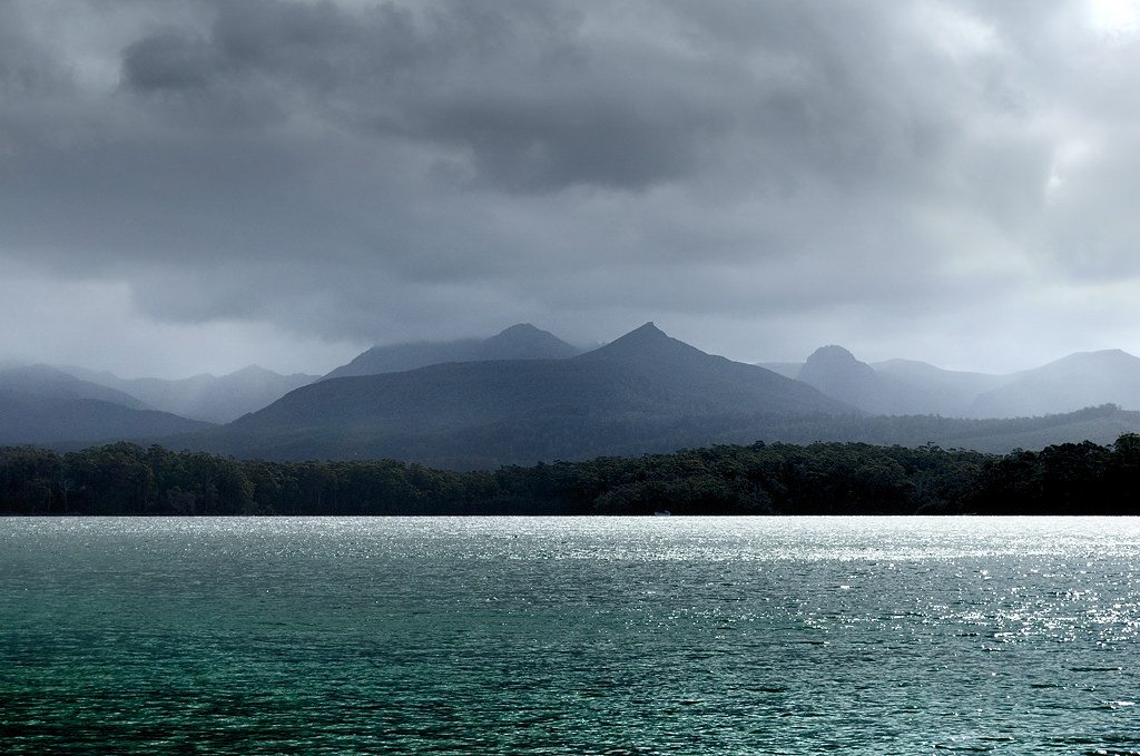 The walk heads east and north east along the southern coast of Recherche Bay. The beaches are quite sheltered, and afford views of the Southern Ranges. The track is mainly along the beaches, with short trips into the scrub. Towards the end there's a longer section across the headland for a few minutes which emerges just west of Fishers Point.
 There are some ruins close to the point. The building was originally the Fishers Point Pilot Station, built in 1843 and designed by colonial architect W. P. Kay, who also designed Government House. The building was also used as a pub in the 1850s, when the local population was huge. There were actually two pubs at Fishers Point, both called the Sawyers Arms. Weird. The sign says you shouldn't touch the brickwork, as this will aid conservation. I must say this instruction wasn't evident to me before I checked it out this visit, and I may have broken the rule... I think they could do with a sign by the ruins if they want people to avoid touching the bricks.
 Fishers Point itself has views from northeast through southeast, and extensive tidepools on the rocks which are worth exploring when the tide is right.
Subscribe to:
Posts (Atom)